Selected Undergraduate Design Studio Projects--Design IV, Fall 2013
Fall 2013
Professor Kevin Bone, Associate Professor Tulay Atak, Instructor Teddy Kofman, Instructor Sophia Krimizi, and Professor Sean Sculley
URBAN TERRITORIES | Landscape, Infrastructure, Architecture
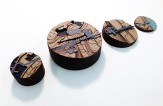
The fall 2013 Forth Year Studio introduced students to urban design by investigating the possibility of integrating architecture, landscape, ecology and infrastructure. Based on the premise that the emerging urban condition transcends the limitations of traditional definitions of these disciplines, the studio sought for design propositions that offer strategies for integration. Establishing constructive forms of exchange between analytical research and design, the studio pursued an exploration and re-imagining of a site that included an archetype of modern urbanism, transitional zones occupied by arterial transit routes, abandoned industrial corridors and spaces that defy definition. These territories, common to many aging post-industrial cities, remain under-utilized and resist becoming part of the city fabric. The work of the studio sought to cultivate and employ different scenarios for the proposed site while examining diverse design approaches of urban transformation. In rethinking the role and relationship between landscape, ecology, infrastructure and architecture, the studio examined the pertinent socio-cultural and urban themes while critically appropriating environmental factors as an integral part of the design process. This implies thinking and designing on a diversity of scales, and taking into consideration an approach where different scales reside in one another.
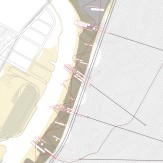
The studio focused on an area at the edge of the Harlem River in Kingsbridge Heights. Sitting on a steep topographical drop, the area is fractured by the multiple lanes of the William Francis Deegan Expressway, four sets of active and inactive railroad tracks and industrial brownfields. The urban tissue is further fragmented by the convergence of diverse morphologies. Hence, topography, infrastructure and urban morphology all play roles in severing the waterfront from urban life. By considering specific edge conditions, the studio was able to explore the possibilities of connection while questioning why and how to strategize connections in an urban context. The rationale for these connections expanded from a desire to reconnect the city to its geographical roots, to propositions for changing land use and facilitate transitions to new models of urban structure.
The site chosen for study was located on the eastern upland banks of the Harlem River—a body of water that has been radically transformed through the industrial era. Historically it was only a small stream course consisting of mostly tidal flats and wetlands. The selected site had very specific geophysical, cultural and historical attributes that impacted the proposed architectural actions. Around 1920, the estuaries of upper Manhattan were dredged out, straightened, re-mapped and referred to as the Harlem River Ship Channel. The stream course was altered and the shore likewise has undergone many changes, from farmland then dockyard and now a lost remnant belonging to industrial neglect. It is also a place that nature, however tenuously, has begun to re-colonize.
The studio addressed a twofold program connecting the Heights with the water, while accommodating, defining and programming a Harlem River center for urban agrarian culture. Both programmatic segments are interwoven with each other, proposing the inhabitation of that transition between the water and the city. The program involved the integration of productive landscape, agriculture, energy, infrastructure, transportation, and all other appropriate ideas of urban life. The center for urban agrarian culture imagined urban agriculture in this specific context, as a new evolving model of human settlement. Projects sought to determine the activities that could take place on site in their own terms and develop programmatic scenarios of occupation and connection.
Projects
-
Transforming the River's Edge
-
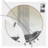
Theater in the (g)round
-
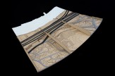
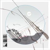
Avenue of Transition
Back
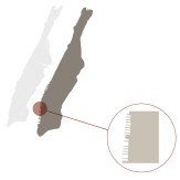
Transforming the River's Edge
Charlie Blanchard
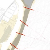
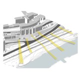
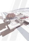
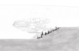
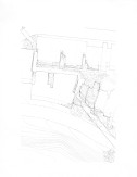
Deriving from an interest in the evolution of the Manhattan edge and the alteration of the Harlem River as a whole, this proposal aims to reinvent and utilize more effectively the river edge that is so prominent on the site. The reality of storm surges hitting the city has become an increasing (contemporary) problem and the section of the site situated between the river and the highway is prone to flooding. The scheme looks to begin the reinvented edge at the 500-year flood line.
A new language of infrastructure is anticipated; one that takes its roots from the piers along the Hudson River edge. What can be found there is a re-appropriation of working piers that were extruded linearly into the water for ships to unload their cargo directly into the Manhattan grid. The planned infrastructure on the Bronx site will be a deconstruction of this original morphology, designed and built for a new purpose.
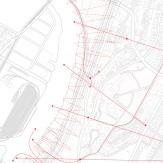
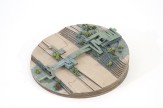
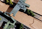
One of the biggest issues raised by this proposal is the bridging of the highway. Rather then completely burying the road, an idea of a hierarchy within the 'pier' typologies is established. Vectors cutting through the top of the site down to the river represent connections and new ways to move from the high part of the site to the lowest. These lines position the major pier type, where the connections over the highway to the river will be made. From there, pedestrians and cyclists are able to move along the new edge via separate paths connecting the main pier structures. Both paths will link to smaller pier types and park nodes, thus, ones perception and experience of this new edge drastically changes depending on how you choose to move through it.
Below this new hard edge, a new soft edge is also developed. This will follow an agrarian garden program, however, a synthesis between the hard and soft edge allows for pedestrians to move freely between the two different edge conditions. Each of the main pier systems will have a diverse programmatic identity. One will compliment the agrarian landscape below, providing storage units, greenhouses, extra allotments and a building for those working. Another will descend from the notion of pleasure piers, the third will be a park, the fourth could potentially provide space for a school, and the fifth, space for housing. Areas along the interconnecting pathways will allow for market stalls to pop up, and the produce that is grown on the site to be sold.
Ultimately, this new infrastructure on the site allows for a rejuvenation of the edge and for the revitalization of the flood plain, allowing it to be put to continuous use.
Theater in the (g)round
Dustin Atlas
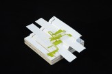
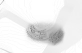
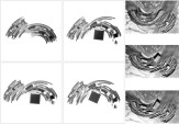
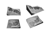
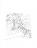
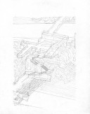
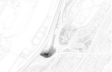
I am proposing an intervention in the site defined by the Major Deegan Expressway on its West, by Landing Road and W. Fordham Road on its South East, and by Sedgwick Ave on its East. This site has a very specific sloped ground condition, one that produces a bowl-like feature in the terrain. In reference to the ancient Greek theaters, which were understood only in the context of their landscape, vistas, and existing ground conditions — I am introducing to our site the program of a theater.
This theater will negotiate the change in elevation through the relationship of spectacle and spectator. In plan, the theater is defined through a series of linear elements understood as lines of force that push and pull from the existing landscape. As a system, these elements can gather and dissipate to form moments of intensity. As such, they produce a specific vector of circulation. There will be no defined edge because this theater is both of and from the city. The lines of force thicken to become architectural elements such as retaining walls, slabs, and steps. These elements serve as structure but also as both stage platforms and terraced seating throughout.
There is no singular defined spectacle of this theater. Rather, the city, the natural landscape, and the theater itself become objects to gaze upon, perhaps even understood as a single entity. In this way, the theater can serve as an urban transformation.
Avenue of Transition
Charles Dorrance-King
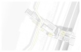
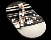
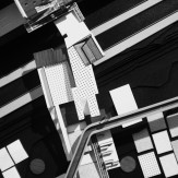
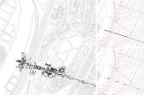
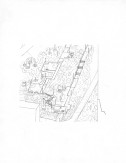
The proposal is for the creation of a clear avenue of transition, engaging a relationship between disparate elements on the site and attempting to blur/soften the hard edges between water, landscape, public space, agriculture, infrastructure and residential.
Placed along one the key vectors identified on the class diagram, this pedestrian avenue will attempt to link up the new development of the previously isolated water's edge with the existing residential and transport links further up the slope of the site.
The program is for a clear passage that runs through the site, acting as a multi dimensional point of transition for the area, and a foundation for the introduction of public space, landscape and agricultural zones along this channel and up the slope that seeps out into the existing residential, in turn encouraging the introduction of residential to move back down the slope towards the river, introducing a permeability, both in materiality and programming.
There are points of confrontation within that transition, with existing architectural volumes, infrastructure, vertical landscape and the new architecture introduced by the rest of the class. It is at these points of confrontation, that an architecture of negotiation will be developed. It is important also to introduce a set of visual landmarks and vistas that help to break up the traversing of this long passage and articulate a more dynamic relationship than Just A to B.
Even though the intention is to create a clear channel through the site, this interaction between the avenue and existing will force the proposal to narrow and thicken when appropriate. So that rather than one dominant berth, this channel becomes a dynamic architecture/infrastructure that when it confronts existing elements will at times slice, crop or coat, at others will give way, but mostly it will be an exercise in merging, blurring, and overlaying the different architectural and programmatic elements that it connects.
One of the key concerns of introducing a large architectural proposal onto a site is its effect on the surrounding. How, rather than creating a large construction site that takes years to build in one go, and articulate how this transition might take effect over time. That there might be several stages of development and remediation to be applied, allowing this avenue's surrounding zones of landscape and agriculture to develop more natural and be aware of how this might happen.

