MASTER OF SCIENCE IN ARCHITECTUREㅤㅤㅤㅤFALL 2023
GRADUATE RESEARCH DESIGN STUDIO I
Michael Young, Associate Professor
Hyper-Homogeneity: Scanning the Aesthetics of the Background
One of the pressing aesthetic questions crossing through contemporary digital media and architecture is that of attention. Our online interactions with digital images are recorded, compiled, processed, and evaluated to determine how and to what our attention is drawn. These interactions often happen in the background, below thresholds of conscious attention, which is similar in many ways to where the aesthetics of the built environment holds much of its influence. Historically, aisthesis was not only concerned with how the world was sensed, but also with how we made sense of our sensations, which included questions of consciousness and attention. Aesthetics in its modern usage is derived from this history, expanding what could be considered the “senses” through media, and “sense-making” through cultural knowledge, discourse, and valuation.
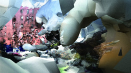
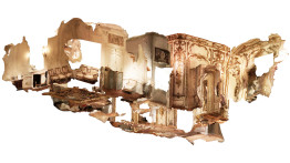
Photogrammetry models reality through images. The environment is sensed as bits of reflected energy, assigned spatial locations in depth, and stored as data points—there are no solids, no surfaces, no lines—only a homogeneous dispersion of colored marks in a matrix. These mediations increasingly determine economies of prediction and surveillance, and thus power and control—concerns which initially seem of much greater importance than those of aesthetics. However, what is attended to by these bureaucracies, be they human or algorithmic, begins with how the world is sensed and made sense of, and thus initially, with aesthetics. For instance, in a photogrammetry model there is no difference between a chair, a tree, a person, a bridge, or a building; foreground and background smush together into a veil of discrete points where spatial depth is conflated with patterns of flat surface decoration, appearing hyperreal from a distance and dematerialized up close. These are aesthetic redistributions which have significant impacts on what it is that one attends to as “real” in the world, effecting both the decisions of data mining and the design articulations of architectural speculations.
During the second half of the semester, each student was asked to take their initial experiments and apply them to two different contexts: the domestic interior of a single room and the urban interruptions of large-scale infrastructure. These two “sites” were chosen for several reasons. There are differences between scanning within volumes versus scanning around objects, there are differences regarding the private and the public, and there are obviously the differences in scale. However, the questions the studio focused on have more to do with tensions that occur once these environments become scanned information. Questions such as: What is private/public space in a hyper-mediated world? What are the relations between surveillance and performance? How is the background of “the everyday” represented? What is the relation between resolution and representation? What happens in the gaps, the shadows behind or within a scanned surface? What does it mean for design speculations to be developed within these modes of representation? Each project worked through these two different sites simultaneously, ultimately producing one project, one exploration, one thesis regarding the conceptual and aesthetic shifts, problems, and possibilities of a world modeled through images.
< Back to Selected Graduate Design Studio Projects
Projects
Absurdity in Double Shadows: Reshaping and Reproducing the Glitch of Everyday Tools
Chia-Ching Hsu
Google Maps is considered to be a projection of the real world; it is used to find destinations, check traffic conditions, and observe landscapes, with many people believing in its authenticity. However, in the northern part of Manhattan's SoHo in New York City, at a certain latitude, houses, streetlights, water towers, and trash cans all have double shadows. This phenomenon is caused by the fusion of satellite imagery at the intersections of different images. This everyday tool conceals the multiple temporalities of space, becoming an absurdity that modern people take for granted.
To further explore these anomalies, this project uses photogrammetry, combining first-person on-site views with satellite perspectives and photos from different times to transform the city into a model with multiple viewpoints and time points. Within this city, blurred by the uncertainties inherent in software systems, the boundaries of objects are redefined, cultivating twenty-four different SoHo Glitch beings. This creates an urban landscape based on real data, characterized by multiple temporalities, multiple viewpoints, and spatial multiplicity, aiming to re-present the systems that support human society and the deviations and absurdities that arise from them.
Unveil: Thermal Infrastructure and Domestic Space in New York City
Kaiyi Ding
This project is explores the hidden dynamics of thermal infrastructure and domestic spaces in New York City; it delves into three core themes: the city’s veil of infrastructure, the cybernetic superstructure linking infrastructure to domestic spaces, and the analogy between human beings and closed systems.
The site—a powerhouse for the IRT subway system—is located on 59th Street and was originally designed by Stanford White of McKim, Mead & White in 1904. It now functions as a ConEdison steam plant, the largest in the U.S., serving over three million New Yorkers. The juxtaposition of a Beaux-Arts façade with an industrial interior reveals the manipulation of urban infrastructure by a private company for profit.
Due to restricted site access, alternative methods such as photogrammetry and technical drawings were employed to uncover the concealed infrastructure. This approach facilitated connections between urban and domestic scales, allowing for the visualization of what is hidden beneath the surface.
Photogrammetry and satellite imagery expose the hidden dynamics of thermal energy and resource concentration in the city. By visualizing the buried infrastructure from a worm’s-eye perspective, this project reveals inequality in resource distribution. The closed, circulating system of infrastructure is analogous to NASA's life-support systems, highlighting the imbalance and hidden realities behind decorative façades.
This project reimagines the built environment, sensing and creating spaces that reveal the true nature of urban infrastructure.
The Authority of Portals
Ralph Karam
I am there and I am not there.
I am a spill of sardines on a marble kitchen island, a bus station, maybe two. I am the counter Authority, and I am not alone: I am transnational too. I am erasure, repair and the fight that is in-between. According to them, I am pixels rather than flesh. A number series, a color code. Flesh must disappear. Everything must be contained, controlled.
The Authority of Portals is a series of captures in the form of photogrammetric models frozen in digital drawings of transnational and local disturbances shared by technological hotspots: the port of Beirut’s Charles Helou Bus Station in Lebanon, and the Port Authority Bus Station in New York. The former has been subjected to Zionist colonial forces, the latter to socio-economic forces that are other. Side by side, the sites reveal themselves to one another: did Beirut build New York? Will New York soon become empty and effaced, destroyed at its port? Which present of one is the future of the other?
The project and its loose ends begin to create a parafictional language around mundane infrastructure projects. By parafictional: the presentation of fiction as fact, where drawings do not distinguish between the bus station and the monster it is, the monster politics that are encoded into its making and becoming.