The CUISD Glacier Folio Project
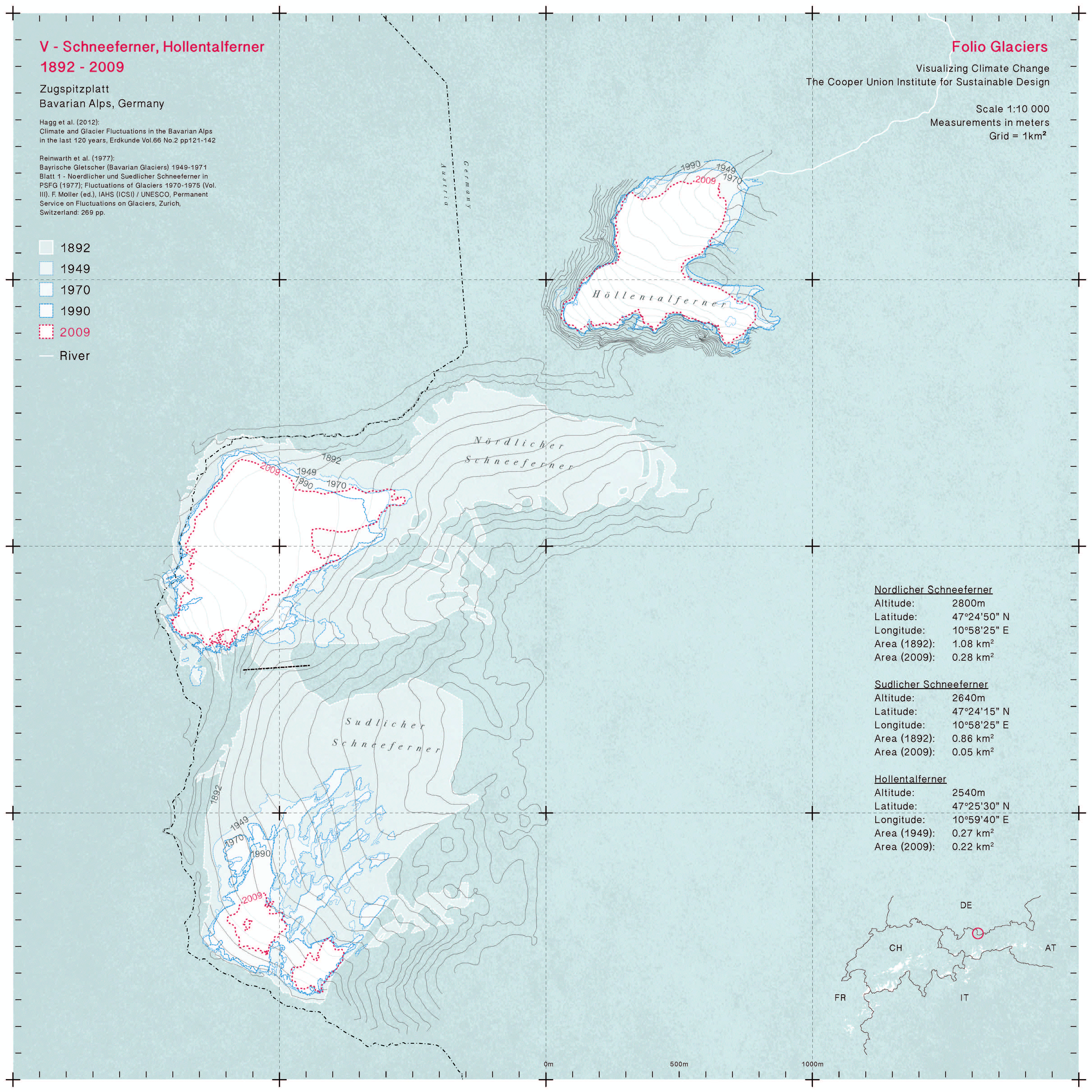
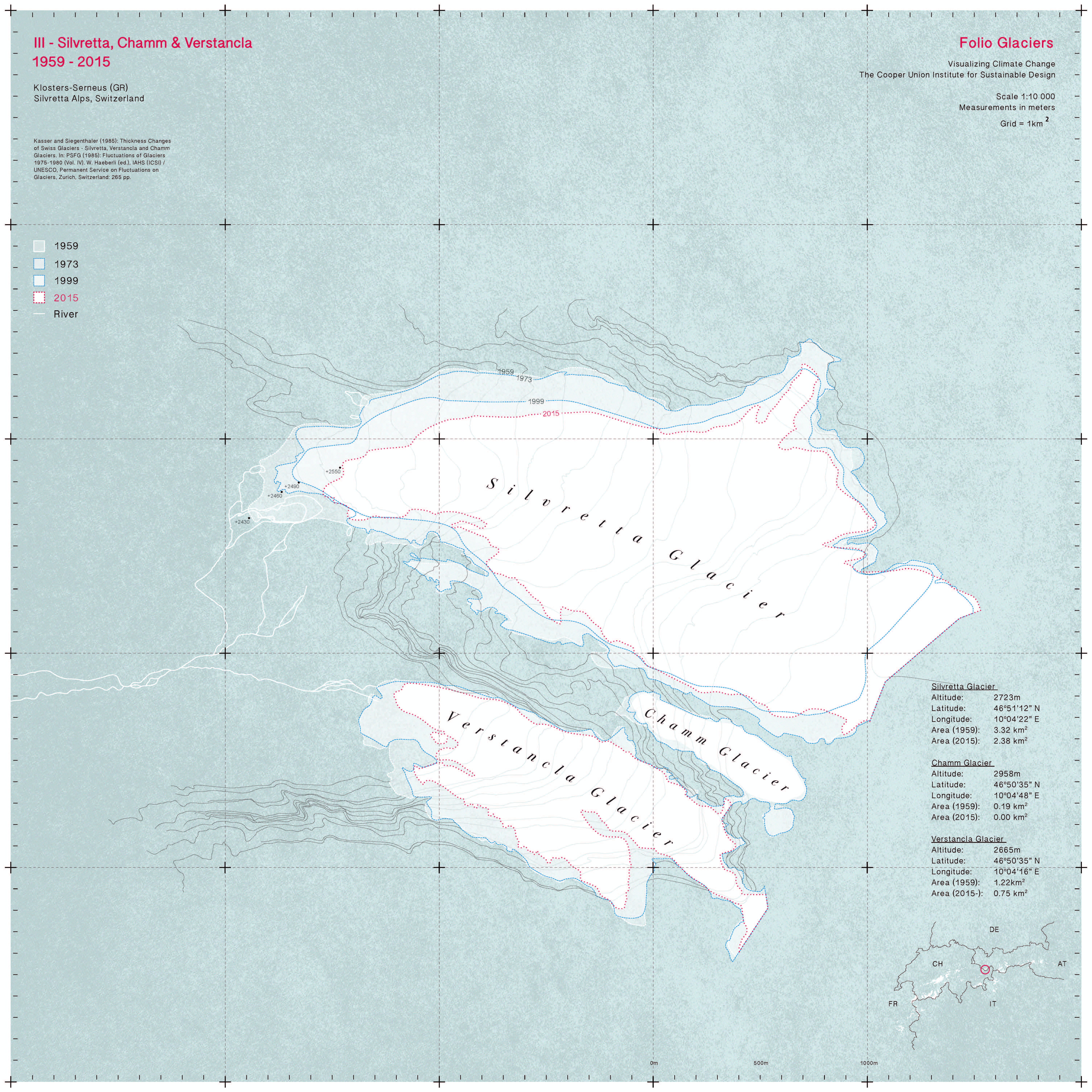
Recognizing that the dramatic loss of glacial land-ice is rapidly increasing and that this loss greatly affects environmental and social ecosystems, this project seeks to document in an accessible, graphic format the changes now occurring to some of the iconic glaciers of earth. The Glacier Folio Project looked at a wide variety of representational strategies that are now used for recording ice field conditions, and set out to develop a clear, uniform cartography method that presents an accessible and visually compelling tool for communicating this ice loss. Using line denotation, the drawings orient the diminishing size of the glaciers throughout the past century by overlaying data sets to form one comprehensive image. As a pilot project, the CUISD selected eight examples including glaciers from mid-latitude Europe, mid and upper latitude sites in North America, and equatorial glaciers in South America. The case study glaciers were selected for their importance to society–as water supplies–and for the clarity of change that has been recorded over an extended period of time. The Glacier Folio Project envisions cataloguing one hundred key glaciers, a resource that will be made available in an on-line Cooper Union archive and ultimately through the production of a fine art lithographic folio. Future areas of study will include Himalayan glaciers, Patagonian Glaciers and the key ice field of equatorial Africa.