The William Cooper Mack Thesis Fellowship
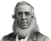
William Cooper Mack
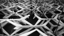
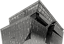
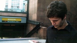
William Cooper Mack Thesis Model, 2006
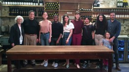
2023 William Cooper Mack Thesis Fellows
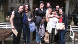
2019 William Cooper Mack Thesis Fellows
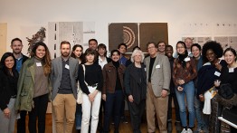
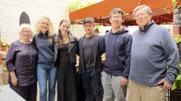
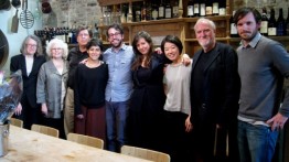
10th Anniversary Celebration of the William Cooper Mack Thesis Fellowship - 2018
2015 William Cooper Mack Thesis Fellows
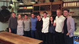
2014 William Cooper Mack Thesis Fellows
2013 William Cooper Mack Thesis Fellows
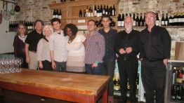
2012 William Cooper Mack Thesis Fellows
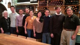
2011 William Cooper Mack Thesis Fellows
2010 William Cooper Mack Thesis Fellows
The William Cooper Mack Thesis Fellowship program was established in 2008 by John and Harriet Mack at The Irwin S. Chanin School of Architecture in memory of their son William Cooper Mack AR’06. Cooper, as he was known to all, first entered The Cooper Union in the School of Art, where he studied for one year before transferring to the School of Architecture. His work welding tradition and research, technology and science, and art and architectonics in the search for new answers to longstanding questions in architecture was recognized through awards and prizes that included the American Institute of Architects Henry Adams Certificate of Merit, the Peter W. Bruder Memorial Fund Structures Prize, and the Bert L. Stern Architectural Award from the Lotos Club Foundation.
The thesis year affords each student in the School of Architecture the freedom to shape, in every sense, a project that stands as a culmination of the design sequence. Thesis students are encouraged to examine personal as well as broad cultural, social, and environmental concerns to generate an architectural solution incorporating program, site, technologies, and poetics. William Cooper Mack Thesis Fellowships are awarded each year to support primary research and inquiry in the development of significant and original thesis projects.
Since 2010, the William Cooper Mack Thesis Fellowship program has had a significant impact on many thesis students and their projects. Ninety-five students have received the award, with research conducted in numerous countries, at locations as diverse as Yeonpyeong Island, South Korea; Port-au-Prince, Haiti; the disputed territory of the Bakassi Peninsula; the Jabalia Refugee Camp, Gaza; Zaragoza, Spain; Manila, Philippines; Stockholm and Malmö, Sweden; Shatila Refugee Camp, Beirut; the historic monument sites of Egypt; Havana and Cienfuegos, Cuba; the southeastern region of Montenegro; ghost towns of Route 66, United States; and cave house settlements in Cappadocia, Turkey. Students have conducted site surveys, oral histories, research at local archives, photographic documentation, studies of indigenous building practices and interviews of community leaders, as integral components toward the making of architecture.
In celebrating the fifteenth anniversary of the fellowship we invite you to support the efforts of our thesis students to broaden the reach and impact of architecture through a contribution to this important program. To make a donation, please click here.
FELLOWSHIP RECIPIENTS (click academic year to view projects)
2023–2024
Abdulrazaq Alabdulmighni | Florence & Rome, Italy
Grace Ballo | Scottsdale, AZ; Oakland, CA
Andrew Hebert | Diyarbakir & Hasankeyf, Turkey
Yuan (Alice) Meng | Tokyo / Kyoto / Osaka, Japan
2022–2023
Minghao (William) Du | Cappadocia, Turkey
Maria Del Carmen Maldonado | Route 66
Nadja Martinovic | Montenegro
Tianyang Sun | Toronto & Markam, Canada
2021–2022
Junmin Chung | Avenel, NJ; Staten Island, NY
Tilok Costa | Roosevelt Ave, Queens, NY
Oleksiy Godz
Kai Huang | London, England
Han Na Kim | US Cities
Maria Eleni Komninou
Sanjana Lahiri | Phoenix, AZ
Harrison Moser | Vieques, Puerto Rico
Ahzin Nam
2020–2021*
Taesha Aurora
Jesse T. Bassett
David L. Bermudez
Shishen Chen
Evgenia Dementyeva
Isaac D. Islas-Cox
Mudong Jung
Maksymilian Mamak
Gabriella Orsi
Stella Blue Porzungolo
Maren Bailly Speyer
Tracy Tan
Brandy L. Vazquez
* As travel was not possible due to COVID-19, students received funding
to purchase thesis material and equipment.
2019–2020
Dylan DeWald | Bologna, Italy
Viktoria Klansoe | Standard Gauge Railway, Kenya
Daniel Smith | Butte, MT
Cheung Lun (Jeremy) Son | Kyoto & Tokyo, Japan
Shuqing Zhan | Manila, Philippines
2018–2019
Mira Almazrooei | London, England
Mireya Fabregas | Madrid, Spain
Vaughn Lewis | Berlin, Germany
Parker Limon | Cairo, Egypt
Natalia Oliveri | Jerusalem, Israel
Zhenni (Jane) Zhu | Campbellsville & Lexington, KY; Quartzsite, AZ
2017–2018
Yu Kiu Rain Chan | Hong Kong, China
Heinrich Dieter Farin
Zachary Christopher Hall | Japan; South Korea
Evan Zane Shirley | The Netherlands
Samuel River Sol | New England, US
Katherine Seana Sullivan | Aran Islands, Ireland
Margaux Nicole Wheelock-Shew | Paris, France
2016–2017
Aelitta Gore | Venice, Italy
Solveig Gunnarsdottir | Stockholm, Sweden
Ian Alexander Houser | Annandale-on-Hudson, NY
Hui Rong Ines Liu | Sydney / Melbourne / Hobart, Australia
Wilson James Muller | Majuro, Republic of the Marshall Islands
Stephanie Restrepo | US / Mexico border
2015–2016
Samuel Young Kwang Choi | Kyoto, Japan
Patrick Collingwood
Max Eugene Dowd | Kigali, Rwanda; Addis Ababa, Ethiopia
Cassandra J. Engstrom | Hong Kong, China
Jemuel Joseph | Montreal, Canada
Jonathan James Ngo | Chacabuco, Chile
Diego A. Salazar | Mexico City, Mexico
2014–2015
John Angelo N. Alonzo | Manila, Philippines
Charlie M. St. C. Blanchard | San Francisco, CA
Charles Dorrance-King | Philadelphia, PA
Maja Hjerten Knutson | Malmö, Sweden
Matthew J. Maiello | Flint, MI
Alexander McLean | Cambridge, MA
Nicholas A. Pacula | Beirut, Lebanon
Andrea S. Recalde | Hobart, NY
Christopher P. Stewart | Tularosa Basin, NM
2013–2014
Eduardo A. Alfonso | Sectarian Communities, NY
Derrick Benson | National Radio Quiet Zone, WV / VA / MD
Lorenzo Bertolotto | L’Aquila, Abruzzo, Italy
Ten-Li Guh | Paterson, NJ
Morgan Gostwyck Lewis | Paris, France
Che D. Perez | St. George’s, Grenada; Port of Spain, Trinidad
Ariana C. Revilla | Socorro County, NM
2012–2013
Oliver Antoniu | Venice, Italy
Ezegbebe Imade Eribo | Bakassi Peninsula, Cameroon
Jeremy P. Jacinth | Rotterdam, The Netherlands
Theodore D. Kofman | Houston, TX
2011–2012
Pamela Lucia Cabrera Pardo | Washington DC; Lima, Peru
Jae Won Chang | Yeonpyeong Island, South Korea
Jessica Helen Russell | Pueblos Communities, NM
Daniel E. Wills | Cuba
2010–2011
Fabio J. Alvino-Roca | Alcañiz, Spain
Salomé Balderrama | Caracas, Venezuela
Janice King Pui Chu | Macau, China
Deborah Ferrer | Guatemala City, Guatemala
Standish Lee | Benxi, China
Emily Vo Nguyen | US Monuments
Jesús Yépez | Salton Sea, CA
2009–2010
Yael Hameiri | Jabalia Refugee Camp, Gaza, Palestine
Angelique J. Pierre | Port-au-Prince, Haiti
Ahmed Ali Zareh | Tehran, Iran